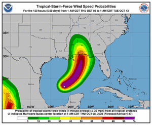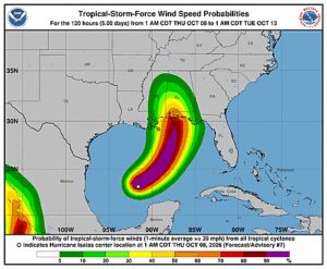
Issued at 1000 AM CDT Thu Oct 08 2026
728
WTNT44 KNHC 081457
TCDAT4

Hurricane Isaias Discussion Number   8
NWS National Hurricane Center Miami FL       AL092026
1000 AM CDT Thu Oct 08 2026

Isaias is strengthening in an environment of moderate vertical wind
shear.  Observations from an Air Force Hurricane Hunter aircraft
indicate that the central pressure continues to fall and the
maximum winds are now near 75 kt.  The center of the hurricane is
near the southwestern side of a Central Dense Overcast feature, and
some convective banding features are evident over the eastern
portion of the circulation.  Additional aircraft reconnaissance
missions are scheduled for today, tonight, and Friday, so we will
have close monitoring of the intensity of the system up until
landfall.

Center fixes from the Hurricane Hunters indicate that Isais
continues on a generally east-northward track with an initial
motion of about 060/9 kt.  During the next 36 hours, the hurricane
should gradually turn toward the northeast and north as it moves
between a ridge extending from the Bahamas across the Florida
Peninsula and a zonally-oriented mid-level trough near the
northwestern Gulf coast.  On the forecast track, the center of the
hurricane is forecast to move across the east-central to
northeastern Gulf coast in 36-42 hours.  Thereafter, the weakening
cyclone should move over the southeastern United States bringing
strong winds well inland.  The track guidance has not changed much
for this advisory cycle and the official forecast is similar to that
of the previous advisory.

The intensity forecast up to landfall is somewhat challenging.
On the one hand, the hurricane should move over waters of high
oceanic heat content and within a fairly moist air mass through
tomorrow.  On the other hand, the SHIPS model input parameters show
a significant increase in vertical wind shear, particularly when
Isais nears the coast.  Regarding, the shorter-term intensity
forecast, a recent WSFM microwave satellite image at 37 GHz
frequency shows a closed ring around the eye.  This is typically a
harbinger of rapid intensification.  The 12-hour forecast does show
a relatively large increase in strength, but in view of the
expected stronger shear in 24-36 hours, some decrease in intensity
is indicated as Isaias approaches the coast.  Regardless, Isaias is
expected to remain a dangerous hurricane through landfall, and
gusty winds are expected well inland after landfall given the
anticipated expansion of the wind field and accelerating forward
speed of the storm.

Key Messages:

1. A life-threatening storm surge is expected from the Mouth of the
Mississippi River to Suwannee, Florida. Residents in the warning
area should follow advice given by local officials and evacuate
immediately if told to do so.

2. Damaging hurricane force-winds are expected over portions of the
Florida Panhandle, southern Alabama, and southern Mississippi where
a Hurricane Warning is in effect. Residents in these areas should
prepare for the possibility of long-duration power outages.

3. Damaging wind gusts are possible over much of central and
northern Alabama and portions of western and northern Georgia,
especially in areas of higher terrain.  Additional Tropical Storm
and High Wind Watches and Warnings will likely be required for
portions of that area later today. Residents should secure loose
outdoor items, avoid driving high-profile vehicles, and prepare for
power outages.

4. Isaias will bring areas of heavy rainfall to the central U.S.
Gulf coast and much of the Southeast Friday into the weekend.
Considerable flash and urban flooding, along with significant river
flooding, will be possible.

5. Isaias could bring gusty winds and areas of heavy rain to the
western portion of the Yucatan Peninsula today.


FORECAST POSITIONS AND MAX WINDS

INIT  08/1500Z 23.7N  90.2W   75 KT  85 MPH
 12H  09/0000Z 24.9N  89.0W   90 KT 105 MPH
 24H  09/1200Z 27.1N  87.9W   95 KT 110 MPH
 36H  10/0000Z 29.6N  87.4W   85 KT 100 MPH
 48H  10/1200Z 32.3N  87.8W   35 KT  40 MPH...INLAND
 60H  11/0000Z 34.6N  88.1W   30 KT  35 MPH...POST-TROP/INLAND
 72H  11/1200Z 36.5N  87.8W   25 KT  30 MPH...POST-TROP/INLAND
 96H  12/1200Z...DISSIPATED

$$
Forecaster Pasch