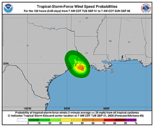
Issued at 1000 PM CDT Tue Sep 01 2026
000
WTNT45 KNHC 020232
TCDAT5

Tropical Depression Edouard Discussion Number   7
NWS National Hurricane Center Miami FL       AL052026
1000 PM CDT Tue Sep 01 2026

Edouard has remained well-organized in radar imagery as it moves
farther inland over southeastern Texas. However, the convective
cloud tops near the center are gradually, if unsteadily warming,
and Doppler wind velocities near the center have decreased during
the last hour or so. Based on this, it is estimated that Edouard
has weakened to a tropical depression. It should be noted that
there have been no reports of winds or pressures from the storm
core area after it passed Beaumont, Texas.

Continued weakening is expected as the center moves farther inland,
and the dynamical guidance suggests that the surface center should
dissipate between 18-36 h. The intensity forecast thus calls for
the system to last 24 h before dissipation.

Edouard is moving northwestward or 315/7 kt and will remain on this
heading through early Wednesday, bringing the center farther inland
over eastern Texas. This general motion should continue until the
surface center dissipates.

This is the last tropical cyclone discussion issued by the National
Hurricane Center on this system.  Future information on this system
can be found in discussions issued by the Weather Prediction Center
beginning at 400 AM CDT, under AWIPS header TCDAT5, WMO header
WTNT45 KWNH, and on the web at www.hurricanes.gov.

Rainfall forecasts for the United States can always be found at
https://www.wpc.ncep.noaa.gov/qpf/qpf2.shtml
and outlooks of flash flood risks can be found at
https://www.wpc.ncep.noaa.gov/qpf/excessive_rainfall_outlook_ero.php
.


Key Messages:

1. Wind gusts to tropical-storm force are likely near the center of
Edouard for the next several hours.

2. Heavy rain will impact parts of the Upper Texas coast through
east-central Texas into far Southwest Louisiana through Thursday
morning as Edouard continues to track inland. Flash flooding is
likely across this region, especially in urban areas. Significant
flash flooding is possible. River flooding may also be possible.


FORECAST POSITIONS AND MAX WINDS

INIT  02/0300Z 30.5N  94.6W   30 KT  35 MPH...INLAND
 12H  02/1200Z 31.2N  95.4W   25 KT  30 MPH...INLAND
 24H  03/0000Z 32.2N  95.9W   20 KT  25 MPH...POST-TROP/REMNT LOW
 36H  03/1200Z...DISSIPATED

$$
Forecaster Beven