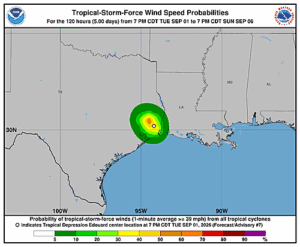
Issued at 400 AM CDT Thu Jul 23 2026
000
WTNT42 KNHC 230838
TCDAT2

Tropical Storm Bertha Discussion Number  16
NWS National Hurricane Center Miami FL       AL022026
400 AM CDT Thu Jul 23 2026

Radar data and surface observations indicate that the center of
Bertha has moved or re-formed offshore of the coast of southern
Louisiana. The storm is producing a large area of intense convection
over the southwestern quadrant, with the elongated low-level center
at the northeastern edge of the convection. Surface observations and
scatterometer data show that the maximum winds are near 40 kt and
the minimum central pressure is near 1003 mb. Coastal Doppler radar
data also shows that the mid-level center is displaced well to the
southwest of the low-level center, and that there has been a
persistent supercell thunderstorm with a mesocyclone moving westward
through Bertha's southwestern quadrant.

The initial motion is a somewhat uncertain 270/11 kt. As before, the
steering mechanism is a large and strong mid-tropospheric
anticyclone over the south-central United States. Bertha should move
along the southern periphery of this feature for the next day or so,
with the center reaching the upper Texas or southwestern Louisiana
coasts later today. After landfall, a west-southwestward motion is
forecast until the cyclone dissipates. The new forecast track is
similar to the previous track. Some erratic motion could occur
before landfall due to possible center reformation caused by
convective bursts.

Continued moderate to strong northeasterly shear and dry air
entrainment should prevent significant strengthening before
landfall. Weakening is expected after landfall, and the cyclone is
forecast to dissipated between 36-48 h.


Key Messages:

1. Tropical storm conditions are expected to spread westward along
the northwestern Gulf Coast from south central Louisiana to the
upper Texas coast today.

2. A Coastal Flood Warning is in effect for portions of the
Mississippi and Louisiana coastlines, where moderate coastal
flooding is expected.

3. Isolated flash flooding is possible along the Texas Gulf Coast
and South Texas through tonight.


FORECAST POSITIONS AND MAX WINDS

INIT  23/0900Z 29.0N  92.2W   40 KT  45 MPH
 12H  23/1800Z 29.3N  94.1W   40 KT  45 MPH
 24H  24/0600Z 29.0N  97.0W   30 KT  35 MPH...INLAND
 36H  24/1800Z 28.5N 100.1W   20 KT  25 MPH...POST-TROP/REMNT LOW
 48H  25/0600Z...DISSIPATED

$$
Forecaster Beven