Issued at 1000 PM CDT Wed Jul 22 2026
000
WTNT42 KNHC 230248
TCDAT2

Tropical Storm Bertha Discussion Number  15
NWS National Hurricane Center Miami FL       AL022026
1000 PM CDT Wed Jul 22 2026

After making landfall in southeastern Louisiana earlier today,
Surface observations show that the center has become less well
defined.  It appears, however, that the center has slipped a little
southwestward and close to the coast of south Louisiana.  Most of
the deep convection continues to be south and southwest of the
center, out over the northern Gulf, due to the persistent
north-northeasterly vertical wind shear.  The overall cloud pattern
is not very well organized, and is elongated from southwest to
northeast.  The intensity estimate is held at 40 kt for this
advisory, with these winds occurring primarily over the Gulf waters.

Bertha has been moving a little south of west over the past several
hours, with the initial motion a faster 260/10 kt.  The main
steering mechanism continues to be a large and strong
mid-tropospheric anticyclone over the south-central United States.
Bertha should move along the southern periphery of this high
pressure area for the next day or two, and is expected to briefly
re-emerge over the northwestern Gulf waters on Thursday. The system
should cross the upper Texas coast later on Thursday and move
inland over Texas after that.  The official forecast track is just
slightly south of the previous NHC prediction, mainly due to the
more southern location of the center, and is close to the latest
corrected consensus, HCCA, guidance.

Since the storm should remain in a dry mid-level air mass with
continued strong north-northeasterly vertical wind shear through
Thursday, significant re-strengthening over the northwestern Gulf
waters is unlikely.  The official intensity forecast is on the high
side of the model guidance, close to the SHIPS prediction.


Key Messages:

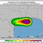
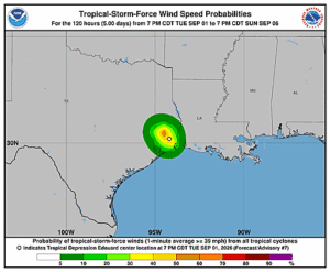
1. Tropical storm conditions are expected to spread westward along
the northern Gulf Coast from Mississippi to southwestern Louisiana,
including the Metro New Orleans area, tonight and on Thursday.
Tropical storm conditions are expected over portions of the upper
Texas coast on Thursday.

2. A Coastal Flood Warning is in effect for the Mississippi and
Louisiana coastlines, where moderate coastal flooding is expected.

3. Isolated flash flooding is possible along the Texas Gulf Coast
and South Texas through Thursday night.


FORECAST POSITIONS AND MAX WINDS

INIT  23/0300Z 29.4N  91.1W   40 KT  45 MPH
 12H  23/1200Z 29.2N  92.8W   40 KT  45 MPH
 24H  24/0000Z 29.1N  95.6W   35 KT  40 MPH...INLAND
 36H  24/1200Z 29.0N  98.3W   25 KT  30 MPH...POST-TROP/REMNT LOW
 48H  25/0000Z...DISSIPATED

$$
Forecaster Pasch