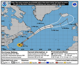
Issued at 500 PM AST Wed Oct 01 2025
000
WTNT44 KNHC 012045
TCDAT4

Hurricane Imelda Discussion Number  21
NWS National Hurricane Center Miami FL       AL092025
500 PM AST Wed Oct 01 2025

Visible satellite images and scatterometer data show that Imelda is
beginning to interact with a nearby front that is impinging on the
northern portion of the hurricane's circulation. Partial ASCAT-B
and -C passes over Imelda reveal that the large wind field is
becoming asymmetric, with the strongest winds occurring over the
western semicircle of the hurricane. In addition, some structural
changes were reported by the Air Force Reserve Hurricane Hunters on
their final pass through Imelda. The eyewall had taken an elliptical
shape and was open to the northeast, unlike the closed circular
eyewall that was reported earlier this morning. The last center
dropsonde indicated the minimum pressure was still around 966 mb.
Based on their peak 700-mb flight-level winds of 93 kt, the initial
intensity is held at 85 kt. Another Air Force Reserve Hurricane
Hunter aircraft is currently en route to investigate the storm.

Tropical storm conditions, especially in gusts, are already being
reported on Bermuda. Imelda continues moving east-northwestward (070
deg) at around 19 kt, with the center expected to pass over or just
south of Bermuda and bring hurricane-force conditions to the island
late tonight into early Thursday. Although the system is moving
quickly, the wind field is growing and becoming asymmetric due to
the early stages of extratropical transition. As a result, the
strongest winds may occur early Thursday morning after the center
has passed Bermuda. The GFS and ECMWF indicate some strengthening
could occur in the near term due to baroclinic interaction, and this
is reflected in the NHC intensity forecast.

After Imelda clears Bermuda and becomes fully extratropical, most
models show the cyclone turning northeastward by late Thursday or
Friday within the flow between a deep-layer trough over the western
Atlantic and a narrow subtropical ridge to the east. This portion of
the track forecast remains challenging. There is still significant
model spread, mostly related to whether the cyclone becomes fully
captured by the trough. The GFS remains a major outlier among the
rest of the global guidance, and the updated NHC track forecast
continues to trend closer to a blend of the ECMWF and Google
DeepMind solutions. Beyond 24 h, steady weakening is forecast while
the extratropical low moves deeper into the mid-latitudes and
gradually fills while becoming stretched out along the front.


KEY MESSAGES:

1. Imelda is expected to bring damaging hurricane-force winds and
large and damaging waves to Bermuda when it passes near or over the
island late tonight into early Thursday. Significant hurricane-force
gusts are likely across Bermuda even after the center passes.

2. Heavy rainfall could cause flash flooding across Bermuda tonight
into Thursday.

3. Swells and high surf from Imelda are expected to produce
dangerous marine conditions and rip currents along much of the East
Coast of the United States and the western Atlantic during the next
several days.


FORECAST POSITIONS AND MAX WINDS

INIT  01/2100Z 31.6N  67.9W   85 KT 100 MPH
 12H  02/0600Z 32.3N  64.1W   90 KT 105 MPH
 24H  02/1800Z 33.2N  58.7W   80 KT  90 MPH...POST-TROP/EXTRATROP
 36H  03/0600Z 34.8N  53.8W   70 KT  80 MPH...POST-TROP/EXTRATROP
 48H  03/1800Z 37.2N  51.1W   65 KT  75 MPH...POST-TROP/EXTRATROP
 60H  04/0600Z 39.5N  49.7W   60 KT  70 MPH...POST-TROP/EXTRATROP
 72H  04/1800Z 42.4N  46.9W   55 KT  65 MPH...POST-TROP/EXTRATROP
 96H  05/1800Z 47.5N  38.0W   45 KT  50 MPH...POST-TROP/EXTRATROP
120H  06/1800Z 49.5N  32.0W   40 KT  45 MPH...POST-TROP/EXTRATROP

$$
Forecaster Reinhart


