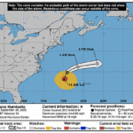
Issued at 1100 AM EDT Tue Sep 30 2025
000
WTNT44 KNHC 301456
TCDAT4

Hurricane Imelda Discussion Number  16
NWS National Hurricane Center Miami FL       AL092025
1100 AM EDT Tue Sep 30 2025

Imelda is gradually becoming better organized, with deep convection
increasing near the center and banding features becoming more
evident.  An Air Force Hurricane Hunter aircraft measured
flight-level winds that supported hurricane strength, although the
central pressure has not yet fallen very much.  The current
intensity is set, perhaps conservatively, at 70 kt.

Imelda is moving northeastward, or around 040/6 kt.  A mid-level
trough near the U.S. east coast should cause the hurricane to
accelerate east-northeastward during the next couple of days.  This
track will bring the center of the hurricane near Bermuda in 36
hours or so.  The official forecast is a bit south of the latest
simple and corrected dynamical model consensus predictions, perhaps
reflecting some binary interaction with the circulation of Humberto
as the pair of tropical cyclones get closer together.

The hurricane is embedded in an environment of moderate
south-southwesterly vertical wind shear, but will be moving over
warm waters and within a moist low- to mid-level air mass.
Moreover, upper-level divergence associated a trough to the
northwest of Imelda is likely to produce some positive forcing for
intensification during the next day or so.  So the system is likely
to be rather potent while it passes near Bermuda.  Later in the
forecast period, the global models show the system merging with a
broad baroclinic zone over the north Atlantic.  The official
intensity forecast is similar to the latest correct consensus model
solution.

KEY MESSAGES:

1. Imelda is expected bring damaging hurricane-force-winds to
Bermuda when it passed near or over that island by Wednesday
afternoon or evening.  A Hurricane Warning is now in effect for
Bermuda.

2. Imelda is likely to cause large and damaging waves in Bermuda.

3. Heavy rainfall could cause flash flooding across Bermuda
Wednesday into Thursday.

4. Swells and high surf from both Humberto and Imelda are expected
to produce dangerous marine conditions and rip currents along much
of the East Coast of the United States during the next several days.


FORECAST POSITIONS AND MAX WINDS

INIT  30/1500Z 29.1N  76.6W   70 KT  80 MPH
 12H  01/0000Z 29.8N  74.6W   75 KT  85 MPH
 24H  01/1200Z 31.0N  71.0W   80 KT  90 MPH
 36H  02/0000Z 32.6N  65.2W   85 KT 100 MPH
 48H  02/1200Z 34.3N  60.0W   80 KT  90 MPH
 60H  03/0000Z 36.7N  53.9W   75 KT  85 MPH...POST-TROPICAL
 72H  03/1200Z 39.3N  50.4W   60 KT  70 MPH...POST-TROP/EXTRATROP
 96H  04/1200Z 43.6N  46.4W   50 KT  60 MPH...POST-TROP/EXTRATROP
120H  05/1200Z 50.5N  37.0W   40 KT  45 MPH...POST-TROP/EXTRATROP

$$
Forecaster Pasch