Issued at 1100 PM EDT Sun Sep 28 2025
078
WTNT44 KNHC 290237
TCDAT4

Tropical Storm Imelda Discussion Number  10
NWS National Hurricane Center Miami FL       AL092025
1100 PM EDT Sun Sep 28 2025

Imelda's cloud pattern has shown little change since earlier today.
There is a prominent band of deep convection over the eastern
portion of the circulation.  Some deep convection is developing
near/over the estimated center position.  Flight-level
winds observations from Air Force and NOAA Hurricane Hunter
aircraft investigating the storm indicate that the maximum winds
remain near 35 kt, although the recent increase of central
convection suggests some strengthening may soon occur.

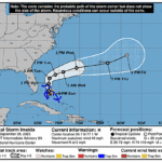
Center fixes from the Hurricane Hunters show that the motion has
been mainly northward with the initial motion estimate remaining
about 360/8 kt.  Imelda should continue this generally northward
track through tomorrow while moving on the western side of a
mid-level ridge.  Then, a trough over the southeastern U.S. is
expected to cause the cyclone to turn sharply east-northeastward.
This track should keep the center of Imelda offshore of the
southeastern U.S. coast.  Later in the forecast period, the system
should move mainly east-northeastward over the subtropical
Atlantic, and pass near Bermuda in several days.  The official
track forecast is similar to the one from the previous
advisory, and close to the model consensus.

Imelda is expected to remain in an environment of moderate
south-southwesterly vertical wind shear for the next few days.  The
system will be moving over warm ocean waters of around 29 deg C and
within a fairly moist mid-level air mass.  Given the mainly
conducive environmental conditions, the cyclone is likely to
strengthen into a hurricane within the next 1-2 days, with
additional intensification likely thereafter.  The official
intensity forecast is at the higher end of the model guidance.  By
the end of the forecast period, simulated satellite imagery from
the global models suggest the cloud pattern of an extratropical
cyclone, and the official forecast shows extratropical transition
around that time.

KEY MESSAGES:

1. Imelda is expected to continue to bring tropical storm
conditions to portions of the central and northwestern Bahamas
through Monday.

2. Rainfall associated with Imelda will continue to impact eastern
Cuba and the Bahamas through Tuesday, which will likely produce
flash and urban flooding.  Mudslides are possible in the higher
terrain.  Heavy rainfall across the coastal Carolinas could cause
isolated flash and urban flooding through Tuesday.

3. The risk of significant wind impacts along the southeastern
United States coast is decreasing, but interests in that area should
continue to monitor the latest forecast updates.

4. Swells and high surf from both Humberto and Imelda are expected
to produce dangerous marine conditions and rip currents along the
east coast of Florida and the Georgia coast through Monday.  These
conditions are expected to spread northward along much of the east
coast of the United States early this week.


FORECAST POSITIONS AND MAX WINDS

INIT  29/0300Z 25.0N  77.1W   35 KT  40 MPH
 12H  29/1200Z 26.3N  77.2W   45 KT  50 MPH
 24H  30/0000Z 27.9N  77.3W   55 KT  65 MPH
 36H  30/1200Z 28.8N  76.5W   65 KT  75 MPH
 48H  01/0000Z 29.4N  74.8W   70 KT  80 MPH
 60H  01/1200Z 30.2N  72.0W   75 KT  85 MPH
 72H  02/0000Z 31.2N  68.3W   80 KT  90 MPH
 96H  03/0000Z 33.4N  61.0W   80 KT  90 MPH
120H  04/0000Z 36.5N  56.7W   65 KT  75 MPH...POST-TROP/EXTRATROP

$$
Forecaster Pasch


