Issued at 500 AM AST Thu Sep 18 2025
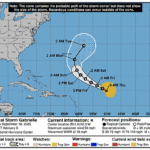
648
WTNT42 KNHC 180834
TCDAT2

Tropical Storm Gabrielle Discussion Number   5
NWS National Hurricane Center Miami FL       AL072025
500 AM AST Thu Sep 18 2025

Gabrielle continues to struggle and consists of a swirl of low-level
clouds with patches of deep convection over the northeast and
southeast quadrants of the storm.  The poor structure is due to
westerly vertical wind shear and a significant amount of dry air
that is continuously entraining into the circulation.  The initial
intensity is held at 45 kt based on the earlier ASCAT data, but this
value is well above the latest satellite intensity estimates.

The atmospheric conditions are expected to remain hostile for a
couple more days, so it seems likely that Gabrielle will either hold
steady or lose strength during that time.  However, the models
suggest that the storm could move into more conducive conditions
late in the weekend and early next week, which should cause
Gabrielle to become more symmetric and strengthen.  The NHC
intensity forecast is near the middle of the guidance envelope for
the first 3 days, but lies closer to the high end of the guidance at
days 4 and 5.

Gabrielle has been moving erratically due to the storm
reorganizing over the past 12 to 24 hours, but smoothing through
the fixes yields a west-northwestward motion at 13 kt.  A continued
west-northwest to northwest motion at about the same forward speed
is expected during the next few days as the storm continues to be
primarily steered by a subtropical ridge over the central Atlantic.
A turn toward the north or northeast is forecast to occur late this
weekend and early next week when Gabrielle rounds the western
periphery of the ridge.  The NHC track forecast is very similar to
the previous one from 12 to 72 h, but it has been shifted a little
to the right at days 4 and 5 to be in better agreement with the
latest guidance.

Confidence in the long range forecast remains low, and interests in
Bermuda should continue to monitor Gabrielle over the next several
days.


FORECAST POSITIONS AND MAX WINDS

INIT  18/0900Z 20.0N  50.3W   45 KT  50 MPH
 12H  18/1800Z 20.8N  51.7W   40 KT  45 MPH
 24H  19/0600Z 21.8N  53.6W   40 KT  45 MPH
 36H  19/1800Z 22.8N  55.7W   40 KT  45 MPH
 48H  20/0600Z 24.0N  57.7W   40 KT  45 MPH
 60H  20/1800Z 25.3N  59.4W   45 KT  50 MPH
 72H  21/0600Z 26.8N  60.7W   50 KT  60 MPH
 96H  22/0600Z 30.2N  61.5W   65 KT  75 MPH
120H  23/0600Z 34.4N  58.3W   75 KT  85 MPH

$$
Forecaster Cangialosi