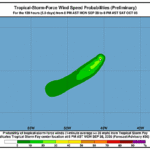
Issued at 1100 PM AST Mon Sep 28 2026
000
WTNT41 KNHC 290236
TCDAT1

Tropical Storm Fay Discussion Number  36
NWS National Hurricane Center Miami FL       AL062026
1100 PM AST Mon Sep 28 2026

The convection around Fay continues to improve during the evening
hours, but is still a bit sheared to the south of the low-level
center. A few cloud tops near -70 C persist, with the objective
intensity estimates from UW-CIMSS in the range of 34-43 kt.
However, the latest TAFB Dvorak fix was a T2.0/30 kt. Based on the
given data, the intensity has been risen to 35 kt for this
advisory, which makes Fay a tropical storm again.

The storm is still moving toward the southwest with an estimated
initial motion of 225/8 kt. This general southwest to west-southwest
motion is expected to persist for the next couple of days as Fay is
guided by the flow along the southern periphery of a mid-level
ridge situated over the central Atlantic. The current NHC track
forecast is very similar to the previous one with just a few minor
adjustments based on the HCCA and GDMI forecast aids.

The intensity of the cyclone is likely to continue to fluctuate
for the next couple of days as convection continues to pulsate, but
that convection will likely be sheared away from the center since
SHIPS guidance indicates increasing shear over the next day or so.
The global models still show that Fay will struggle to maintain
deep convection once it moves into a more stable air mass and an
area of upper-level convergence. The current NHC intensity forecast
only shows minor changes in intensity with Fay becoming a
post-tropical cyclone in a day or so, then degenerate into a trough
in a few days.

FORECAST POSITIONS AND MAX WINDS

INIT  29/0300Z 26.0N  45.9W   35 KT  40 MPH
 12H  29/1200Z 25.1N  47.1W   35 KT  40 MPH
 24H  30/0000Z 23.9N  49.2W   30 KT  35 MPH
 36H  30/1200Z 23.1N  51.1W   30 KT  35 MPH...POST-TROP/REMNT LOW
 48H  01/0000Z 22.8N  53.0W   30 KT  35 MPH...POST-TROP/REMNT LOW
 60H  01/1200Z...DISSIPATED

$$
Forecaster Katz/Hagen