Issued at 900 AM GMT Thu Aug 13 2026
619
WTNT43 KNHC 130847
TCDAT3

Tropical Depression Cristobal Discussion Number   4
NWS National Hurricane Center Miami FL       AL032026
900 AM GMT Thu Aug 13 2026

Recent OSCAT data showed that Cristobal has weaken to a tropical
depression with max winds around 30 kt. The cyclone continues to
have a lack of deep convection based on satellite images. The most
current TAFB intensity estimates with a Final T number of 1.5 and
maximum winds of 30 kt. As a result, the initial intensity has
been brought down to 30 kt for this advisory.

Based on the increasingly harsh environmental conditions that the
storm is entering as well as the latest model guidance, Cristobal is
expected to continue weakening, and it is unlikely that convection
will make a comeback.  Thus, the NHC forecast now calls for
Cristobal to become a remnant low within the next 12 h, with
dissipation following soon after.

The current motion estimate is east-northeastward, or 075/14 kt.
The cyclone is expected to turn a bit more northeastward over the
next 12 h, and barely any changes have been made to the previous NHC
track prediction.


FORECAST POSITIONS AND MAX WINDS

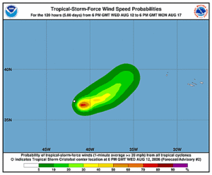
INIT  13/0900Z 38.6N  38.2W   30 KT  35 MPH
 12H  13/1800Z 40.1N  36.2W   25 KT  30 MPH...POST-TROP/REMNT LOW
 24H  14/0600Z...DISSIPATED

$$
Forecaster Katz/Beven