Issued at 500 AM EDT Wed Oct 01 2025
000
WTNT44 KNHC 010855
TCDAT4

Hurricane Imelda Discussion Number  19
NWS National Hurricane Center Miami FL       AL092025
500 AM EDT Wed Oct 01 2025

Imelda has continued to become better organized overnight with a
more-defined eye and an increasingly symmetric inner core on
satellite imagery.  Data from an earlier Air Force Hurricane Hunter
mission supported the previous 75-kt assessment with 82-kt
flight-level winds and a central pressure near 976 mb.  Since the
aircraft departed, the satellite presentation has continued to
improve, so the initial intensity is set slightly higher at 80 kt.

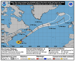
The hurricane is accelerating towards the east-northeast, with the
latest motion estimated to be 070/17 kt. A faster east-northeast
motion is expected soon in the strong flow ahead of a large-scale
trough over the western Atlantic.  The 00 UTC guidance suite did
provide some wrinkles to the forecast, with much of guidance showing
an eastward motion later today as Imelda experiences northerly flow
behind the approaching trough.  This nudges the system farther
south, with many aids south of Bermuda now after being more centered
on the island 6h ago.  At this point, the core of Bermuda is still
expected to be close to the island late today, and residents should
expect deteriorating conditions this afternoon.   Beyond that
point, the guidance spread becomes massive, with the ECMWF and GFS
models about 1600 miles apart at day 5, dependent on whether the
trough eventually picks up the hurricane or not.  For now the GFS
looks like an outlier solution so it won't be weighed much in this
forecast, but the new NHC track is slower overall.

Imelda is expected to continue to strengthen and grow in size while
it approaches Bermuda as a category 2 hurricane.  After it passes
the islands, shear greatly increases, but Imelda should undergo a
favorable trough interaction, keeping it producing hurricane-force
for a couple more days as a powerful extratropical low.  Imelda is
also expected to cause the ongoing high surf and swells to persist
over a large portion of the central and western Atlantic for the
next several days due to the forecast size of the cyclone.  The new
intensity forecast is on the high side of the guidance, but a bit
lower than the 00 UTC ECMWF model solution.


KEY MESSAGES:

1. Imelda is expected to bring damaging hurricane-force winds when
it passes near or over Bermuda late this afternoon or evening.  A
Hurricane Warning is in effect for the island.

2. Heavy rainfall could cause flash flooding across Bermuda later
today into Thursday.  Large and damaging waves are also expected on
the island.

3. Swells and high surf from both Humberto and Imelda are expected
to produce dangerous marine conditions and rip currents along much
of the East Coast of the United States during the next several days.


FORECAST POSITIONS AND MAX WINDS

INIT  01/0900Z 30.2N  72.1W   80 KT  90 MPH
 12H  01/1800Z 31.1N  69.0W   85 KT 100 MPH
 24H  02/0600Z 32.2N  64.0W   85 KT 100 MPH
 36H  02/1800Z 33.4N  58.0W   80 KT  90 MPH...POST-TROPICAL
 48H  03/0600Z 35.0N  53.0W   75 KT  85 MPH...POST-TROP/EXTRATROP
 60H  03/1800Z 36.7N  50.5W   70 KT  80 MPH...POST-TROP/EXTRATROP
 72H  04/0600Z 39.7N  48.4W   60 KT  70 MPH...POST-TROP/EXTRATROP
 96H  05/0600Z 44.8N  41.3W   50 KT  60 MPH...POST-TROP/EXTRATROP
120H  06/0600Z 49.0N  33.0W   45 KT  50 MPH...POST-TROP/EXTRATROP

$$
Forecaster Blake


