Issued at 500 AM EDT Sat Sep 27 2025
945
WTNT44 KNHC 270843
TCDAT4

Potential Tropical Cyclone Nine Discussion Number   3
NWS National Hurricane Center Miami FL       AL092025
500 AM EDT Sat Sep 27 2025

Satellite imagery this morning shows an increase in vorticity at
the western edge of a convective cluster located near the Ragged
Islands in the Bahamas. However, this has not reached the stage
where it could be called a well-defined center of circulation.
Based on this, the system is continued as a potential tropical
cyclone with maximum winds near 30 kt.

The initial motion is a somewhat uncertain 315/6 kt.  Later today,
the system should turn north-northwestward between the subtropical
ridge over the Atlantic and a deep-layer trough over the
southeastern United States.  The track models are in good
agreement during this part of the system's life, and this portion
of the new forecast track is almost the same as the previous track.
After 72 h, the guidance continues to be quite divergent. Most of
the deterministic and consensus models now show a turn toward the
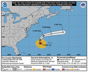
east caused by Hurricane Humberto passing to the east of the system
and breaking down the ridge. However, the HMON and HAFS-A models
still show landfall in the southeastern United States, as do several
ECMWF and GFS ensemble members. Given the current guidance and the
trends, the new forecast track calls for a slow turn to the
northeast and east after 72 h, but at a much slower forward speed
than most of the guidance. It should be noted that while this
forecast keeps the system offshore, it would still be large enough
and close enough to cause wind and coastal flooding impacts along
the southeastern U.S. coast, as well as heavy rainfall/flooding
concerns in inland areas.

Based on current trends in the satellite imagery and the global
models, the disturbance will likely take another 12-18 h to become
a tropical cyclone. After that happens, strengthening is expected
through 72 h as the system moves through an upper-level wind
environment of moderate shear and strong divergence. The intensity
forecast continues to show the system reaching hurricane strength
in 3-4 days, which is in agreement with the intensity consensus.
Some weakening is expected by 120 h due to shear and possible
interaction with a frontal system approaching from the northwest.


KEY MESSAGES:

1. The disturbance is forecast to become a tropical storm this
weekend and bring tropical storm conditions to portions of the
central and northwestern Bahamas, where Tropical Storm Warnings are
in effect.

2. Rainfall associated with this system is expected to impact
eastern Cuba, Hispaniola, Jamaica, and the Bahamas through the
weekend, which will likely produce flash and urban flooding.
Mudslides are possible in the higher terrain.

3.  There is an increasing threat of heavy rainfall early next
week from coastal Georgia through the Carolinas and into the
southern Mid-Atlantic states, which could cause flash, urban, and
river flooding.

4. The system is expected to be at or near hurricane intensity
when it approaches the southeast U.S. coast early next week, where
there is a risk of storm surge and wind impacts. Residents in that
area should monitor updates to the forecast and ensure they have
their hurricane plan in place.


FORECAST POSITIONS AND MAX WINDS

INIT  27/0900Z 21.9N  75.8W   30 KT  35 MPH...POTENTIAL TROP CYCLONE
 12H  27/1800Z 22.5N  76.4W   30 KT  35 MPH...POTENTIAL TROP CYCLONE
 24H  28/0600Z 23.8N  77.0W   35 KT  40 MPH...TROPICAL STORM
 36H  28/1800Z 25.3N  77.5W   40 KT  45 MPH
 48H  29/0600Z 27.0N  77.9W   50 KT  60 MPH
 60H  29/1800Z 28.8N  78.5W   60 KT  70 MPH
 72H  30/0600Z 30.2N  78.8W   65 KT  75 MPH
 96H  01/0600Z 31.5N  78.7W   65 KT  75 MPH
120H  02/0600Z 31.5N  77.8W   55 KT  65 MPH

$$
Forecaster Beven


